Drone 360° Images for Height View Simulation
Visualize the real views of your real estate projects before building them. We capture the exact perspective, meter by meter, of every future floor or terrace.
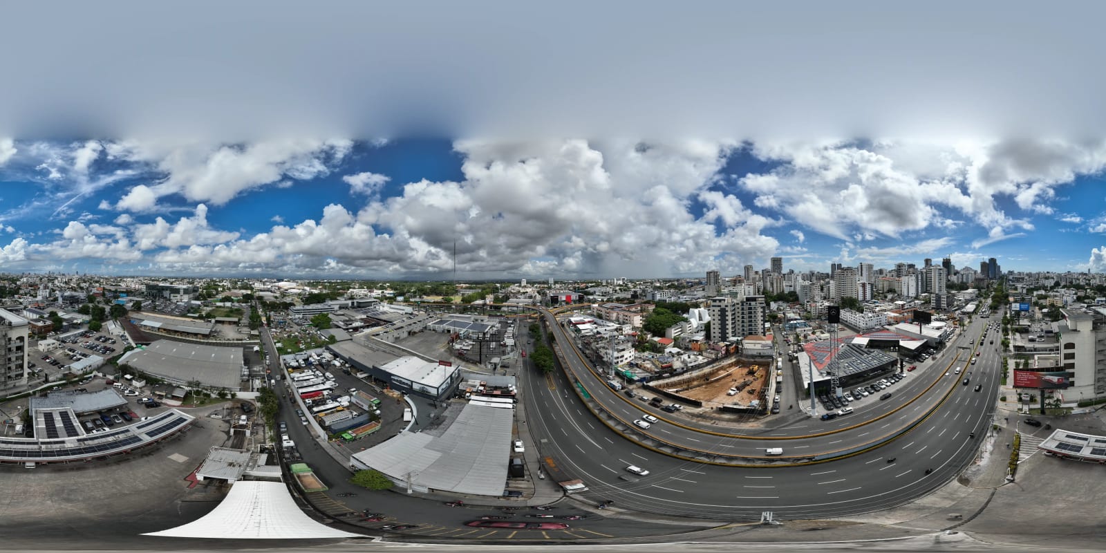
Visualize the real views of your real estate projects before building them
Optimize the pre-sale marketing of your projects with high-resolution aerial 360° photography. Offer your investors and buyers a hyperrealistic immersive experience that accelerates decision-making and delivers complete visual certainty.
Centimeter-Precise GPS
Margin of error under 10 cm in altitude. Every floor captured exactly where it will be.
Compatible with 3D Renders
RAW/DNG files optimized for Lumion, V-Ray, 3ds Max, Blender, and Unreal Engine.
Interactive Virtual Tours
Clients switch floors with a click, rotate 360°, and see nearby points of interest.
Up to 12K HDR Resolution
Equirectangular images of 11,520 × 5,760 px. Zoom without loss of detail.
HDR Bracketed — Natural Light
3 to 5 exposure brackets to naturally balance skies and shadows.
Completely Clean Nadir
Complete drone removal at the bottom point. Uninterrupted panorama.
Technical Specifications of the 360° Drone Service
To guarantee perfect architectural integrations and sharp visualizations, we work under the strictest industry standards.
- Capture Resolution
- Equirectangular images up to 12K (11,520 × 5,760 px) for lossless detail zoom
- Altimetric Precision
- GPS and barometric sensor altitude lock with a margin of error under 10 centimeters
- Delivery Format
- Source files RAW / DNG (maximum dynamic range) + processed JPG / TIFF
- Professional Stitching
- Complete drone removal (clean nadir) + chromatic aberration correction
- Luminic Consistency
- Bracketed HDR 3 to 5 exposures to naturally balance skies and shadows
- Rendering Software
- Lumion · V-Ray · 3ds Max · Blender · Unreal Engine
- Virtual Tour Platforms
- Kuula · 3DVista · CloudPano · Matterport · Native WebVR
Specialized Services
Floor View Simulation (Pre-sale)
We fly the drone to the exact height of each planned level (e.g., Floor 5 at 15 m, Floor 10 at 30 m). We capture the exact panorama the client will have from their future balcony or window.
Render Backplate Integration (Photocomposition)
We deliver the real 360° environment with optimized lighting so your architecture team can insert the 3D building model identically to reality.
Interactive Aerial Virtual Tours
Interactive web platform where users switch floors with a click, rotate 360°, and view nearby points of interest like beaches, avenues, and parks.
Service Plans & Pricing
From $370 USD · Custom quotes available
Basic Commercial Plan
Up to 3 fixed heights
- ✓3 GPS-precise heights/floors
- ✓8K HDR resolution
- ✓Professional stitching — clean nadir
- ✓Interactive web link (6 months)
- ✓Processed JPG / TIFF
- ✓Delivery in 5 business days
Developer Pro Plan
Up to 10 fixed heights
- ✓10 GPS-precise heights/floors <10 cm
- ✓Maximum 12K HDR resolution
- ✓RAW / DNG files for 3D renders
- ✓Custom interactive virtual tour
- ✓Professional stitching — clean nadir
- ✓Compatible with Lumion, V-Ray, 3ds Max, Blender
- ✓Delivery in 7 business days
Corporate / Tower Plan
Up to 25 fixed heights
- ✓25 GPS-precise heights/floors <10 cm
- ✓12K HDR resolution + completely clean nadir
- ✓360° property video
- ✓Interactive points of interest hotspots
- ✓RAW/DNG files for renders
- ✓Full multi-floor virtual tour
- ✓Compatible with Unreal Engine, Matterport, Kuula
- ✓Delivery in 10 business days
Projects with more than 25 levels or special requirements — free custom quote.
Frequently Asked Questions
- How is the exact floor height guaranteed in the simulation?
- We use drones equipped with dual GPS positioning systems and real-time calibrated barometric sensors. This allows us to lock the drone at the exact altitude in meters requested by architects, with a variation margin of less than 10 centimeters.
- Are the images compatible with 3D rendering software?
- Yes. We deliver images in equirectangular format up to 12K in TIFF or full dynamic range HDR JPG, ready for use as backplates or lighting environments in Lumion, V-Ray, 3ds Max, and Blender.
- What is professional stitching and why does it matter?
- Stitching joins multiple individual shots into one perfect equirectangular image. Our process completely removes the drone from the nadir (bottom point), corrects chromatic aberrations, and ensures uniform color transitions between each capture.
- Can I use the 360° images on my website or sales presentations?
- Yes. We deliver files optimized for web visualization platforms like Kuula, 3DVista, CloudPano, and Matterport. We also provide high-resolution static versions for PDFs, presentations, and architectural renders.
- How many floors or heights can I include in one project?
- It depends on the selected plan: the Basic Plan covers up to 3 heights, the Developer Pro Plan up to 10, and the Corporate/Tower Plan up to 25 fixed heights. For projects with more than 25 levels, we provide a custom quote.
- What does the Interactive Virtual Tour include?
- The virtual tour allows end users to switch floors with a single click, rotate 360° at each level, and view nearby points of interest like beaches, avenues, and parks. It is delivered as a shareable web link optimized for mobile and desktop.
Ready to showcase your projects like never before?
Let's talk about your real estate project and design the perfect view simulation.